ERDAS imagine Download (Latest 2026) - FileCR
Free download ERDAS imagine Latest full version - Unleashing the Power of Remote Sensing.
Free download ERDAS imagine Latest full version - Unleashing the Power of Remote Sensing.
Free Download ERDAS IMAGINE for Windows PC as a powerful software suite developed by Hexagon. With its advanced capabilities in remote sensing, image processing, and spatial modeling, it has become an indispensable tool for professionals and researchers in agriculture, environmental monitoring, urban planning, and disaster management. In this article, we will delve into the features, benefits, and system requirements, shedding light on how it enables users to unlock valuable insights from geospatial data.
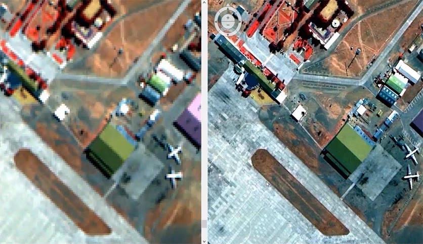
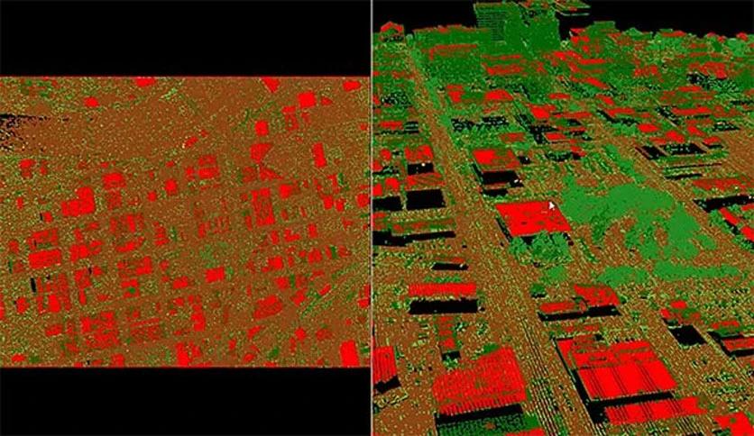
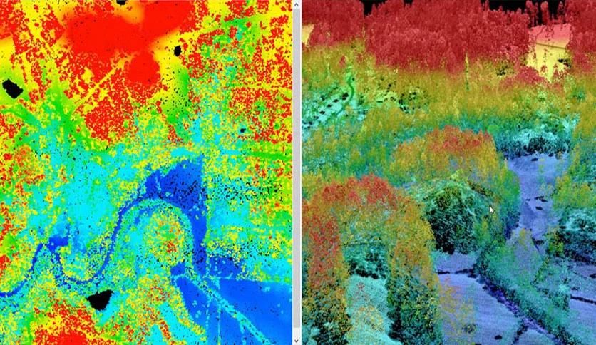
It provides various remote sensing capabilities, allowing users to process and analyze satellite and aerial imagery. It supports various data formats, including multispectral, hyperspectral, and LiDAR data, enabling users to extract meaningful information from diverse sources. With its advanced algorithms, users can perform image classification, change detection, and land cover mapping, among other tasks.
It offers an extensive image processing tool suite that empowers users to enhance, manipulate, and analyze imagery. From basic operations like image rectification, mosaicking, and georeferencing to sophisticated tasks such as radiometric correction and pan-sharpening, the software provides a comprehensive set of tools for image manipulation.
It allows users to create and execute spatial models, enabling them to automate complex geospatial workflows. Leveraging the Graphical Modeler allows users to string multiple processing steps and algorithms to streamline repetitive tasks. This feature saves time and ensures reproducibility and consistency in analysis.
This software allows users to fuse data from multiple sensors and sources, facilitating a comprehensive understanding of the Earth's surface. It enables the integration of different data types, such as imagery, elevation data, and vector data, resulting in rich and informative composite datasets.
it equips users with advanced analytical capabilities, enabling them to extract valuable insights from geospatial data. From detecting changes in land cover to assessing vegetation health and monitoring urban growth, the software provides a suite of spatial analysis and interpretation tools.
This software seamlessly integrates with other geospatial software and platforms, allowing users to leverage additional functionalities. It supports interoperability with industry-standard tools like ArcGIS, ENVI, and QGIS, enabling data exchange and collaboration across different platforms.
Despite its powerful features, it offers a user-friendly interface that caters to novice and experienced users. The intuitive graphical interface, comprehensive documentation, and online resources ensure a smooth learning curve and efficient utilization of the software's capabilities.
This software has emerged as a dominant remote sensing and geospatial analysis force. Its comprehensive features, advanced analytics capabilities, and seamless integration with other software make it a valuable tool for professionals and researchers. By leveraging the power, users can unlock the potential of geospatial data, enabling informed decision-making and a better understanding of our ever-changing world. You can embark on a geospatial exploration and analysis journey with the proper system requirements.
Leave a comment
Your email address will not be published. Required fields are marked *