Opencartis Spatial Manager for AutoCAD Professional Download (Latest 2026) - FileCR
Free download Opencartis Spatial Manager for AutoCAD Professional 9.6.1.17012 Latest full version - Import, export, transform, and manage spatial data.
Free download Opencartis Spatial Manager for AutoCAD Professional 9.6.1.17012 Latest full version - Import, export, transform, and manage spatial data.
Free Download Opencartis Spatial Manager for AutoCAD Overview for Windows PC. It is a powerful AutoCAD plug-in designed for users who need to import, export, transform, and manage spatial data quickly and inexpensively. This innovative tool offers functionalities not typically found in AutoCAD, making it an essential addition for professionals working with geospatial data.
It revolutionizes the way spatial data is handled within AutoCAD. It seamlessly integrates into the AutoCAD environment, providing a comprehensive suite of tools for importing, exporting, transforming, and managing spatial data. Whether working with geographic information systems (GIS), mapping, or design projects, it streamlines your workflow and enhances productivity.
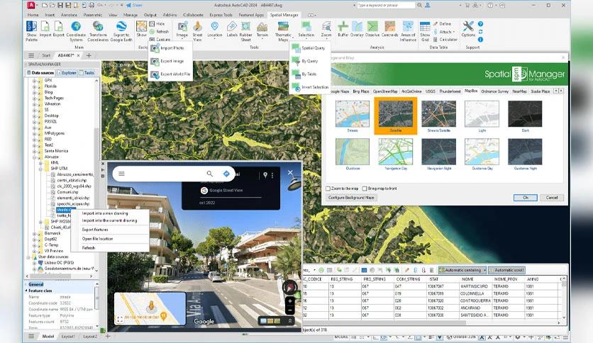
One of the standout features is its ability to effortlessly import and export geospatial data between AutoCAD drawings and various file formats, data servers, or data stores. It ensures seamless interoperability, whether dealing with shapefiles, KML, GeoJSON, or any other standard spatial data format.
This tool lets you easily overlay background maps directly from popular online mapping services such as Google Maps, Bing Maps, and OpenStreetMap within your AutoCAD drawings. This feature provides valuable context for your spatial data and enhances visualization. Additionally, the software allows for the efficient management of alphanumeric data and data tables associated with your spatial datasets.
This software empowers users to easily create terrain models and contours, making it ideal for engineering, construction, and land development projects. Furthermore, the software offers robust tools for transforming coordinate systems, ensuring accurate spatial data integration across different coordinate reference systems.
This program's advanced search and query capabilities simplify finding specific locations within your spatial datasets. Whether you're searching for addresses, landmarks, or geographic features, the software provides intuitive tools for locating and querying spatial data within your AutoCAD drawings.
Spatial Manager for AutoCAD is an indispensable tool for spatial data users. Its comprehensive suite of features, including import and export capabilities, background maps, terrain modeling, and search functionality, makes it a must-have for professionals in various industries. Integrating geospatial data management into the AutoCAD environment enables productivity, streamlines workflows, and facilitates more informed decision-making.

Leave a comment
Your email address will not be published. Required fields are marked *