Free Download Arqcom CAD-Earth for AutoCAD for Windows is designed to import easily/export images, objects, and terrain meshes between Google Earth and major CAD programs and create dynamic contour lines and profiles.
Overview of CAD-Earth for AutoCAD
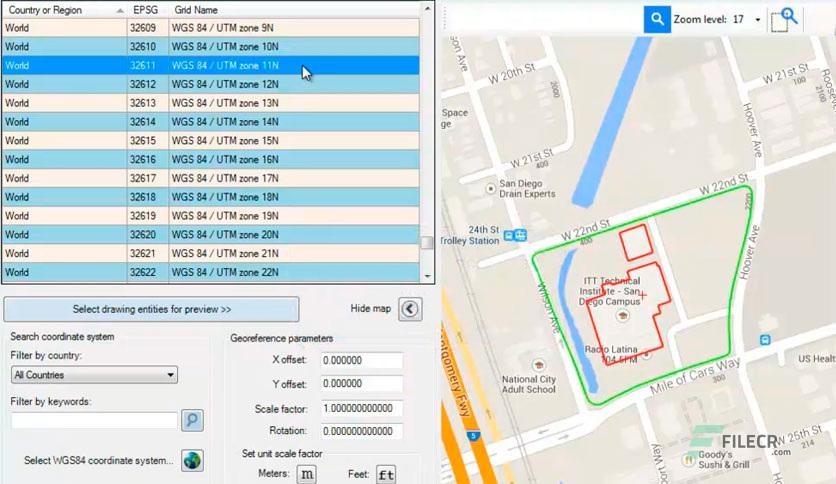
Insert images. You can select different service providers (Google, Bing, Yahoo, Ovi), image resolution (standard, medium, high, highest), and image mode (satellite, map, hybrid). Images can be imported to full-color CAD programs or grayscale in major image formats (BMP, JPEG, TIFF) and clipped inside a closed polyline. Create a world text file containing spatial data information to georeference imported images.
Export CAD objects to Google Earth. Lines, polylines, arcs, circles, and points can be exported to Google Earth as polygons, routes, or placemarks. Object line thickness, outline, fill color, and can adjust the opacity. Can control curve smoothness by specifying the maximum segment length and deflection angle? Can also set the placemark name, description, scale, and icon.
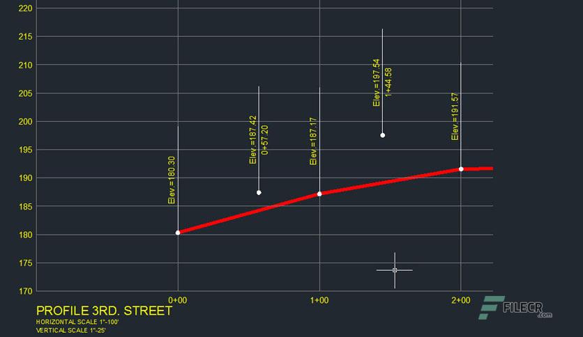
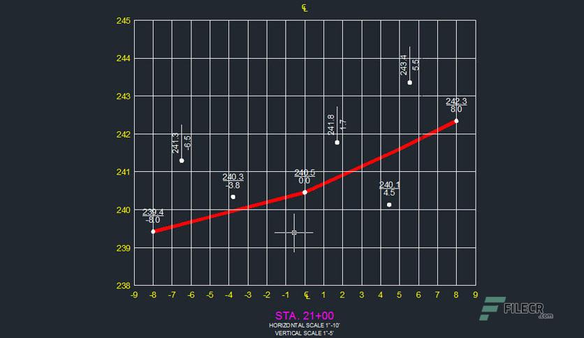
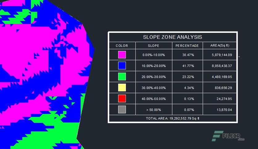
Get contour lines, profiles, and sections from Google Earth (Plus version). Create a terrain configuration mesh inside a closed polyline or along a polyline path calculating point elevations from Google Earth. Specifying the origin point, rotation angle, and distance between rows and columns can adjust the mesh density and precision. Can use the resulting mesh to obtain contour lines, dynamic profiles, and section drawings complete with annotations.
Features of CAD-Earth for AutoCAD
- Easy to use commands. You can pick CAD-Earth commands from a toolbar, the screen menu, or the command prompt. Automatic command loading in each CAD session and extensive help in each step.
- Persistent dialog box settings. Once you set options for a dialog box, they are automatically saved. Therefore, you don't have to set them each time you use a CAD-Earth command.
- Dynamic object updating. The corresponding contour lines, profiles, or sections are dynamically updated when you modify object settings.
- Free direct technical assistance by the programmers. You can request new features and technical support directly from the programmers on the CAD-Earth menu. Remote technical support via TeamViewer is available on request at no extra charge.
Technical Details and System Requirements
- CAD Compatibility: AutoCAD 2017-2022
- Supported OS: Windows 11 / Windows 10 / Windows 8.1 /Windows 7
- Processor: Multi-core Intel i5 Series or above, Xeon or AMD equivalent
- RAM: 4GB (8GB or more recommended)
- Free Hard Disk Space: 1GB or more recommended
Leave a comment
Your email address will not be published. Required fields are marked *