3Dsurvey 4.1.1 Full Version Free Download - FileCR
Free Download 3Dsurvey 4.1.1 Full Version - Offline Installer for Windows - Mapping and Aerial Image Processing Software.
Free Download 3Dsurvey 4.1.1 Full Version - Offline Installer for Windows - Mapping and Aerial Image Processing Software.
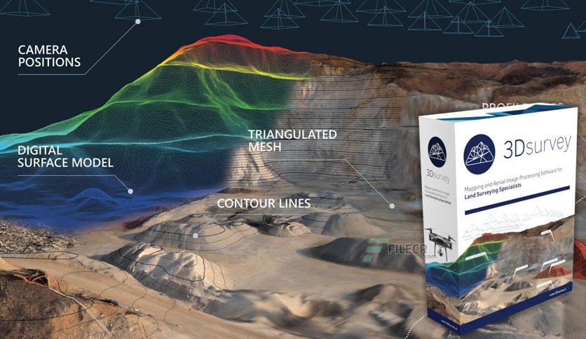
Free Download 3Dsurvey full version standalone offline installer for Windows is a software solution for land surveying data processing.
Take a photo with any standard digital camera, import images into a 3Dsurvey, produce orthophoto maps and digital surface models, and calculate volumes faster and more efficiently. Data is processed automatically based on matching algorithms. Use innovative tools to be even more efficient.
This 3D survey software is designed to work with any digital camera, DSLR or GoPro. Use any UAV to capture aerial terrain images.
Get the most accurate results in a fast and elegant manner. A developer team of experienced land surveyors and devoted computer vision specialists understands first-hand the importance of your result accuracy.
Being fast and efficient at land surveying projects daily is the foundation of 3D survey. This software is developed based on experience from more than 300 end-customer drone projects!
Leave a comment
Your email address will not be published. Required fields are marked *